1851 Enumeration District 4
1851 Enumeration District 11a
“Part of the Township of Bawtry. All that part of the Township of Bawtry which lies to the East of Turnpike Road leading from Retford to Doncaster including the south side of Wharf Street, Church Street, Church Lane, Chapel row, Fieldings Row, Pearsons Row, Ross’s Row, Swan Lane, Ship Inn Yard, Low Street, Bridge Lane, Lamberts Yard, South Parade, the East side of High Street and Birleys Yard.”
Sequence:
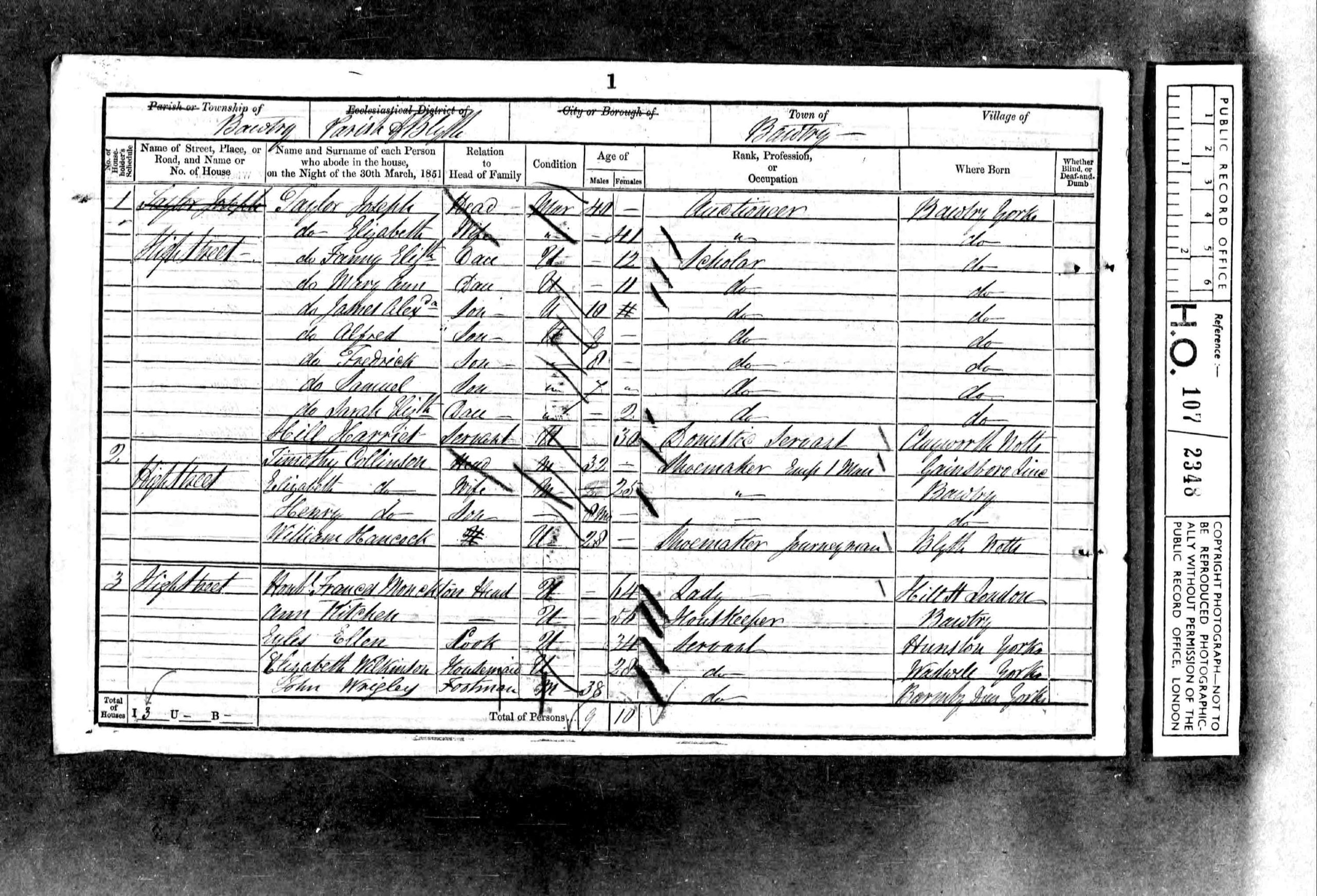
High Street
Swan Lane
Heath(s) Yard
South Parade
Low Street
Lam(?) Yard
Low Street
Bridge Lane
Low Street
Ship Yard
Low Street
Ross Row
Low Street
Ross Yard
Church Street
Fielding(s) Row
Chapel Row
Gass Works
Wharf Street
Ivy House
Church Street
St Pauls(?) Church Lane
Church Street
Pearsons Row
Low Street West
Church Street East
Church Street West
Church Street East
Morleys Yard
Summary
Houses 140 + 15 Uninhabited / building
Individuals651
1851 Enumeration District 11b Description
“Part of the Township of Bawtry in the Parish of Blyth Comprising the Hall, Bull Yard, West side of High Street, Top Street, Scott Lane, Youdan’s Terrace, Near Field House, North End, Priory place, School Hill,
Railway Station, Misson Road and North side of Wharf Street”
Sequence:
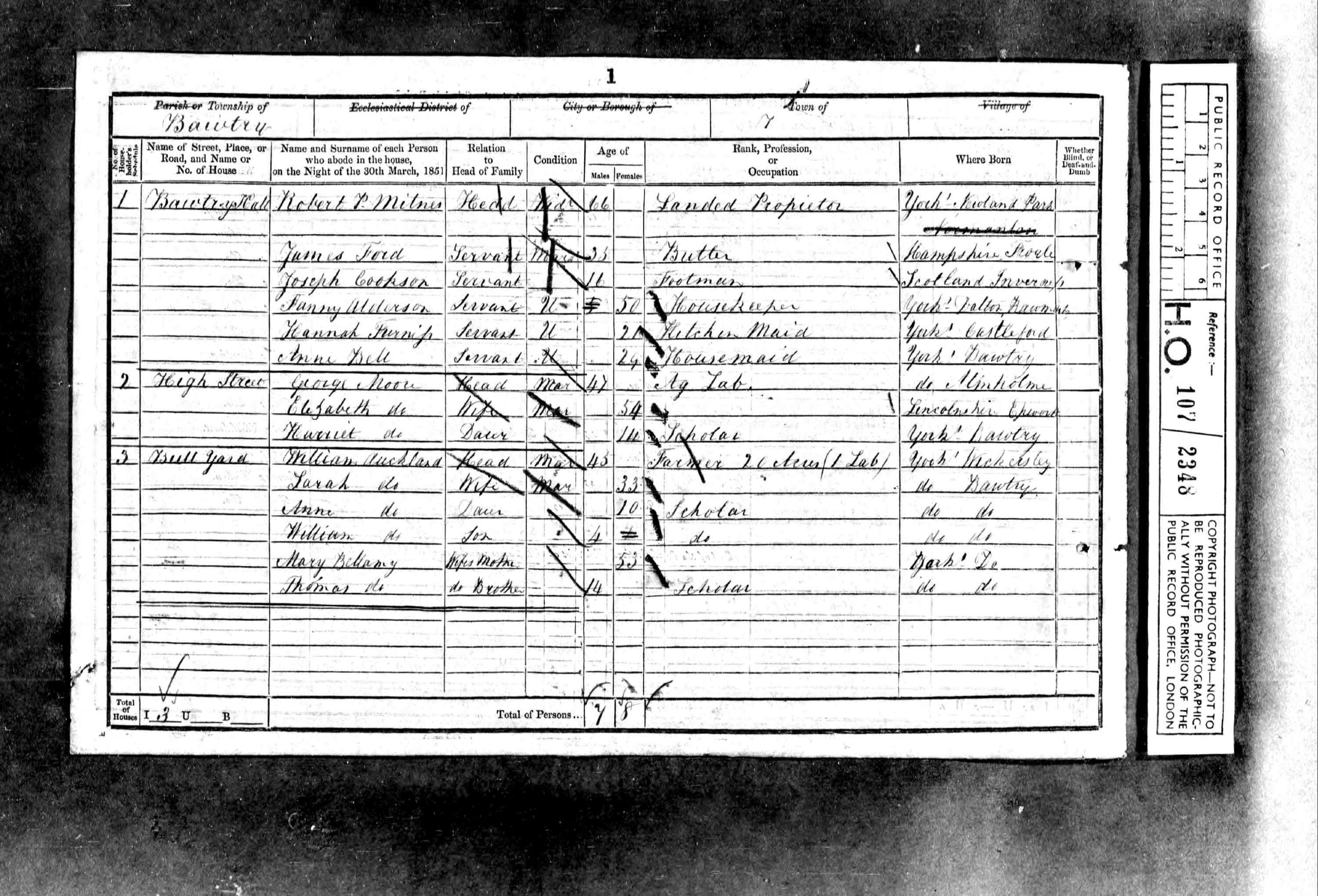
Bawtry Hall
High Street
Bull Yard
Bull Inn
High Street
Angel Inn
High Street
Crown Inn
High Street
Top Street
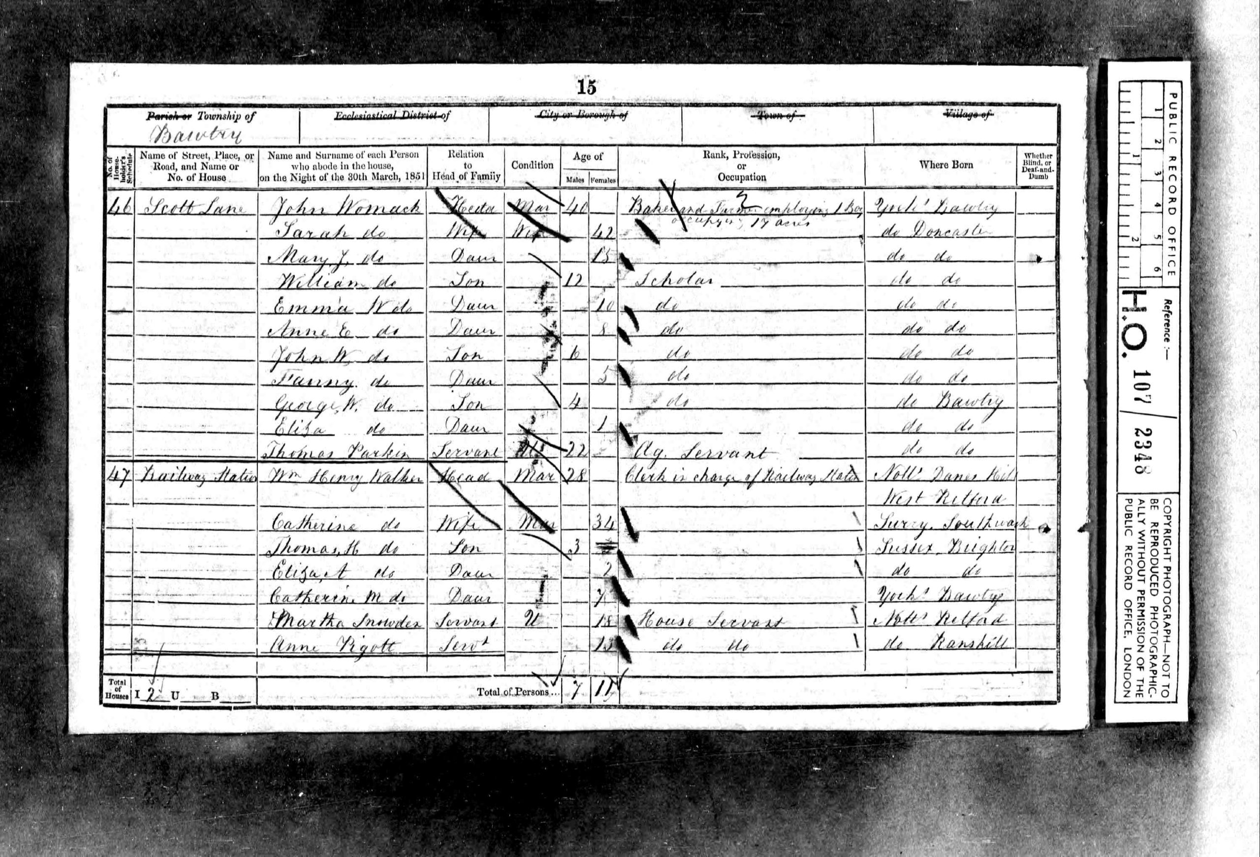
Scott Lane
Railway Station
Misson Road
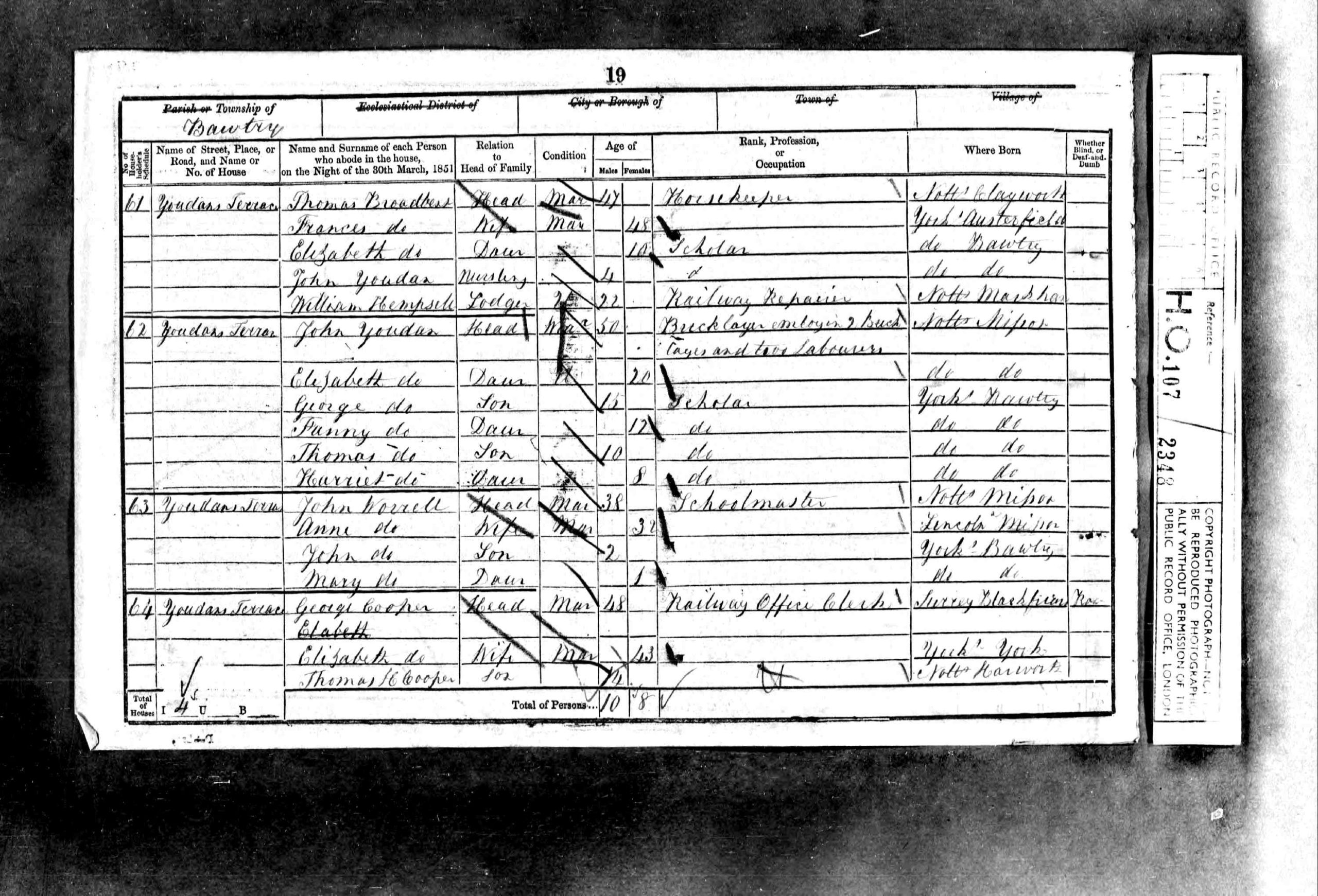
Youdans Terrace
Near Field House
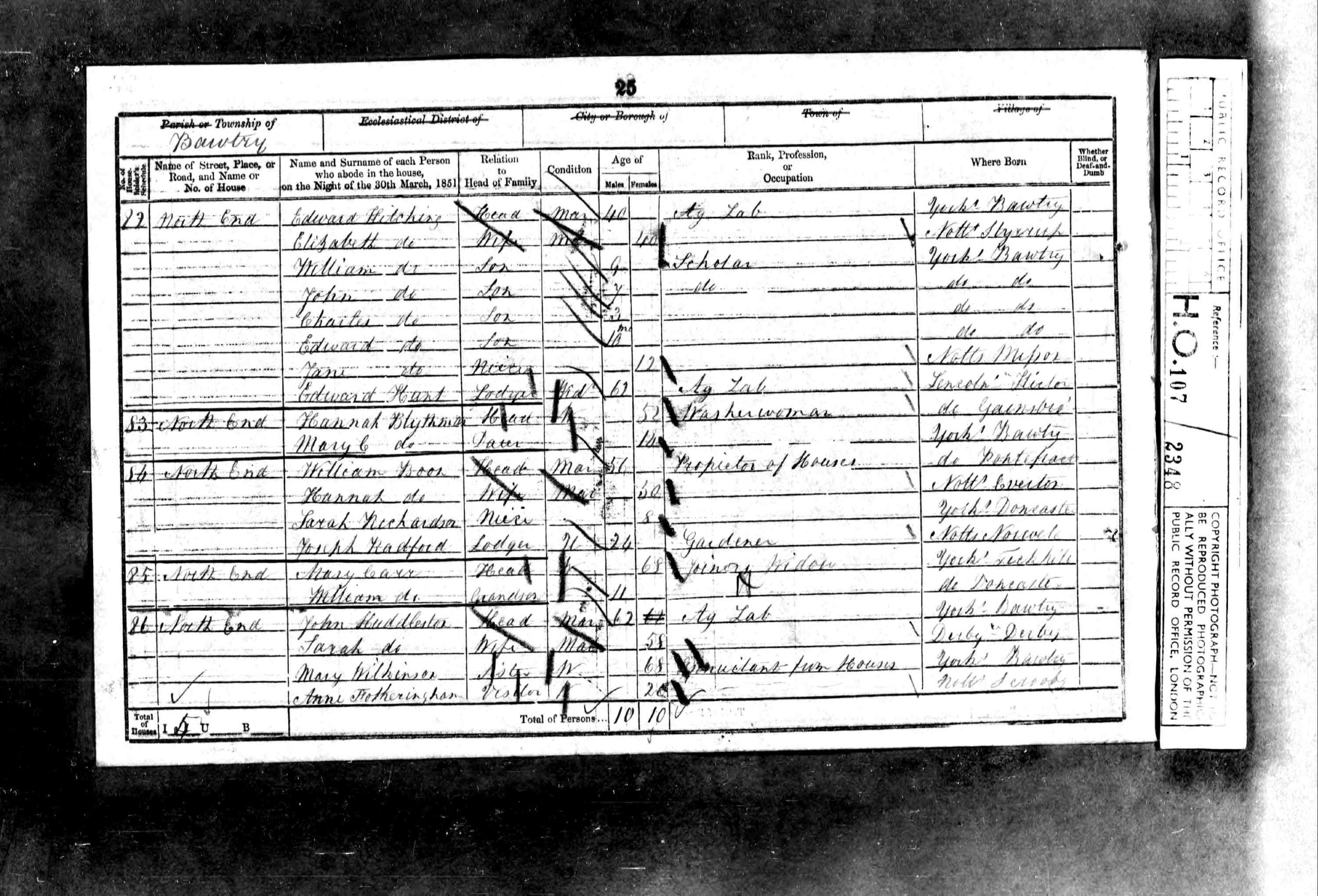
Town End (North)
School Row
Granby Inn
North End
Priory Place
North End
Wharf Street
Summary
Houses 106 + 2 Uninhabited / building
Individuals 515
Summary of both districts
Houses 246 + 17 Uninhabited / building
Individuals1166